Posts

Bagdad: A California Desert Ghost Town
Image
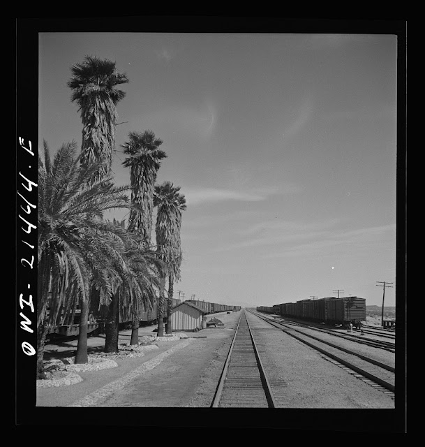
Bagdad, CA is another Route 66 ghost town  in San Bernardino County, CA. A product of the railroad, it would ultimately be superseded by Interstate 40, when 66 no longer functioned as a through route. However, this is not a tale of a town destroyed by a freeway or re-alignment, as this town peaked long before I-40 was built, the bypass was just another nail in the coffin. Like many nearby towns, it got its start in 1883 when the Atchison Topeka & Santa Fe Railway was built between Needles and Barstow, CA. During this time, it served as a stop for mining workers north and south of the area. Even at its peak, only a few hundred people called the town home. Towns built by the railroad usually were platted in 10 mile increments to allow steam engines to take on water, supplied by about 20 tank cars a day to replenish tanks in the area, which otherwise is completely dry being in the middle of the Mojave Desert.  The town is actually the US record holder for consecutive ...

Project Carryall: The Time the Santa Fe Railway Almost Detonated a Nuclear Bomb

Image
Save 15 Miles or More Off Your Railroad Mileage By Switching to Nuclear! If you think the words "nuclear" and "railroad" shouldn't exist in the same sentence, you're probably not the Atchison Topeka & Santa Fe Railway in the early 1960's. When we think of nuclear bombs, we typically associate them as weapons, since the vast majority are used in military circles, but with the nuclear age came the potential to use these weapons not as deterrence or the annihilation of humanity, but rather construction projects.  Just one year removed from the Cuban Missile Crisis , in 1963 the AT&SF wanted to harbor this technology to re-align their railroad near Ludlow, CA , as well as Route 66 and the brand new Interstate 40 , and save about 15 miles off of the mainline right-of-way. Map of the proposed nuclear blasting and re-alignments. Public domain image via Atomic Skies The idea was to straighten the Santa Fe mainline between Needles and Barstow, as well as...

What Happened to US Highway 66's Spur Routes?

Image
While the history of Route 66 is extremely well documented, both by myself and other transportation historians and bloggers, its child routes don't often get the same amount of attention. Of course, none of these routes had anywhere near the impact of 66 on our culture, but I think each one has a bit of interesting discussions about them to blog about. US Route 66 had seven spur routes from 166 to 666, with two different 366's in existence at different points in history, although none of these roads' legacies came close to that of its parent, with the possible exception of the infamous Devil's Highway , which necessitated a numbering change to US-491 in 2003. While Route 66 itself has a fairly bloody and dark history that isn't as discussed as much in nostalgia, so too does a few of its spur routes. EB US-166 assurance shield. Alex Nitzman photo. The poor engineering and high speeds of US-666 were the actual catalysts of the fate of the Devil's Highway, and a...

The Melrose Trolley Trestle

Image
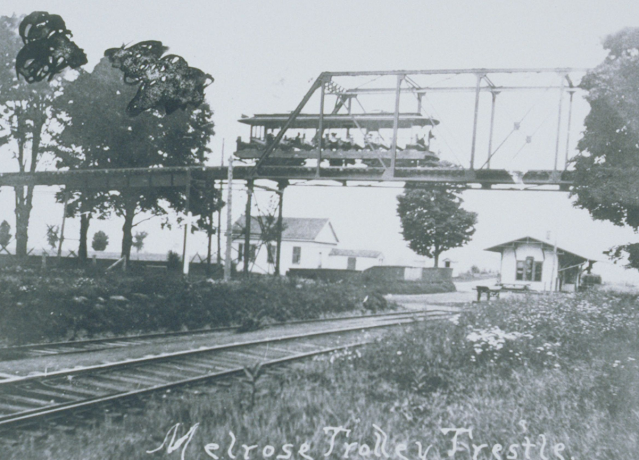
 As I was building my map of the Connecticut Central Railroad for our last blog, I stumbled upon an abandoned right of way that was too interesting to not share! More accurately, a trestle of the Hartford and Springfield Street Railway that once ran over the former Melrose Station on the Connecticut Central Line. ( Present-day satellite view ) The interurban line ran from Windsor Locks, CT to Rockville, CT along what is mostly present day CT-140 and CT-83.  Melrose Trolley Trestle in the foreground with the Melrose Station in the background. University of Connecticut Archives. The bridge is described as follows by Cecil Donahue in East Windsor, " The New York, New Haven & Hartford Railroad tracks running through Melrose hindered a trolley line to Rockville. A 500-foot-long trestle, known as a "roller coaster” trestle, was installed to span the tracks, and on May 20, 1906, the Rockville line was open. Although the trestle was of lightweight construction, built by the Be...

The Original Connecticut Central Railroad (1871)

Image
In 1871, at nearly the apex of the railroad boom created out of competition, a group of investors sought to challenge the success of the  Hartford and New Haven Railroad  between the fledgling cities of Hartford, CT and Springfield, MA, by building their own railway on the opposite site of the Connecticut River between the two cities.  The group would call the line the "Connecticut Central Railroad", and would attempt to secure financing and construction for the road in spite of the challenges to the company's existence brought forth by the New York New Haven and Hartford Railroad. Nonetheless, the company was able to secure funding for the line, and begin construction in 1874, opening two years later in 1876. For the Massachusetts segment of the line, the company secured the earlier, still unbuilt, right of way of the  Springfield & Longmeadow Railroad , which would be re-chartered as the Springfield and New London Railroad to meet the Connecticut Central a...

Why is a short road in Will County named the Chicago-Bloomington Trail?

Image
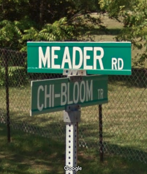
There's a mystery I've been wanting to solve each time I venture down Cedar Rd in central Will County. A slightly-over one mile stretch of road extends from Cedar Road to Hadley Road in unincorporated Will County, near the similarly named settlement of the same name . Were it not named the Chicago Bloomington Trail, it wouldn't bear much though, but given how it's quite far from Chicago, and very far from Bloomington, IL, the nearest Bloomington that comes to mind, one has to wonder if it is a surviving relic that was once part of a much longer road/trail? Chicago-Bloomington Rd at Meader Rd. ( Google Maps Street View ) The answer, like with many roads in the US, is yes, or more accurately, perhaps . It has its origins in old Indian trails , but was plowed as a singular route between Chicago and Bloomington in 1831-34 by new settlers looking  to connect their claims on bodies of water and provide easy access to trade amongst themselves and within the two cities. The or...

The Historic New Orleans Snowstorm of New Year’s Eve 1963

Image
New Orleans is certainly not a city known for snow, but on the last day of 1963, it experienced a rare and memorable snowstorm that covered the city in 4.5 inches of white powder. The snowstorm was part of a larger weather system that affected much of the southern United States, bringing record-breaking snowfall to some areas. The snowstorm had an impact on the city’s culture, economy, and sports, as well as creating some beautiful and unusual scenes. On New Years Eve of 1963, University of Alabama Head Football Coach “Bear” Bryant prophetically said that the only thing that could have messed up his team’s chances in the Sugar Bowl against  Ole Miss  in New Orleans, LA was a freak snowstorm.  Well, that's just what they got, as 4.5" of the white stuff fell the day before the game.  Groundskeepers clearing the snow before the Sugar Bowl at Tulane Stadium. Image: The Times-Picayune,  NOLA.com The snowstorm was caused by a low-pressure system that orig...