Posts

Showing posts with the label river

An Abandoned Railroad Bridge is Being Turned Into a Kansas City Attraction

Image
Kansas City will be getting a new attraction in the Summer of 2024, as a new entertainment district, restaurant and trailhead is being built over the Kansas River. The most interesting part of this plan, to me at least, is the fact that they are building it on an abandoned railroad bridge, much like Trestle Park in Milwaukee , but with much larger ambitions! Rendering of the central truss. Image courtesy of Rock Island Bridge. If you are looking for a unique and exciting place to visit in Kansas City this summer, you might want to check out the Rock Island Railroad Bridge , a historic structure that is being transformed into an entertainment district and venue over the Kansas River. (Location on our Railroad Points of Interest Map ) In fact, The Wall Street Journal and New York Times just listed the KC area as a top place to visit in 2024, and Rock Island Bridge was listed as a key reason.  Rock Island Bridge schematic. Image courtesy of Rock Island Bridge. Groundbreaking on the pr...
Pinhook, Missouri (1927-2011): A Black Ghost Town

Image
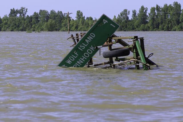
Pinhook, Missouri , a small town situated approximately 8 miles west of the Mississippi River, holds a significant place in history as a black community founded by sharecroppers in 1927. Due to limited options for settlement from white landowners refusing to sell their land, these determined individuals settled in low-lying land that would later prove perilous during flood seasons. ( Location on our Ghost Towns Map ) The status of Pinhook is both a story of ongoing climate change as well as the lackluster emergency response from the government, who in fact made Pinhook's perilous situation even worse. Image: Steve Zumwalt/FEMA via Vox Magazine . Five years after its foundation, the Army Corps of Engineers built the Birds Point-New Madrid Floodway to ease the annual flooding along the Mississippi River, in an attempt to save the then-prosperous City of Cairo downstream. The floodway, when used, put the excess waters directly in the path of the town. ( ProPublica ). At its peak, the ...

Ancient Courses of the Mississippi River Map

Image
One of the most fascinating maps I’ve seen are the Ancient Courses of the Mississippi River by cartographer  Harold Fisk for the Army Corps of Engineers . The maps (they run up and down the Lower Mississippi River), show the present (c.1944) course of the river, as well as how that course has changed over time through stages.  The Mississippi River has not remained static over time. It has been constantly shaped by natural forces such as erosion, sedimentation, floods, earthquakes, natural and anthropogenic climate change, tectonic movements, and glacial cycles. These forces have caused the river to change its course, width, depth, and speed over time. The river changes course continuously, as do all rivers. Along the way from Lake Itasca, MN to the Gulf of Mexico, the Mississippi River shapes the landscape, culture, and history of 10 states and countless communities. But how did this mighty river come to be? And how has it changed over time? These maps help to answer that que...