Posts

Showing posts from 2018

Trestle Park in Milwaukee

Image
The Trestle of Trestle Park. FRRandP photo collection. Trestle Park is Milwaukee's tiny answer to the growing trend of linear parks in major cities which utilize abandoned railroad corridors, in the same vein as Philadelphia's Rail Park  and New York City's amazing High Line . While Trestle Park is much smaller than the other parks mentioned, after visiting it, I can say it nonetheless has a great charm in it's small size. Looking from one end of the park to the other. The Park opened earlier this year after being proposed and approved in 2017 . The signature trestle pictured, while certainly it's namesake, isn't part of the park. The park, located in the Historic Third Ward neighborhood south of downtown Milwaukee is part of the Third Ward RiverWalk, along the Milwaukee River. It is part of a large scale redevelopment of the area as well, which was quite obvious on the drive to the park. Many new condos, restaurants, and businesses make up the nearby

UTA's "S" Line, A Railroad Reactivation

Image
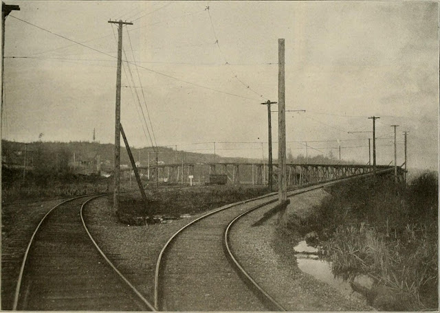
Utah Transit Authority , or UTA's, S Line, otherwise known as the Sugar House Streetcar , is an example of a railroad line reactivated post abandonment.  The streetcar runs a 2 mile back and forth route in the Sugar House neighborhood of Salt Lake City along a once abandoned Denver & Rio Grande Western/Union Pacific right of way known simply as the Sugarhouse Branch . It connects to Central Pointe Station , where riders can connect to the rest of Salt Lake City's light rail system. Image: Robert Holman, 2014 The line was passed down to Union Pacific, who abandoned the line in 2005. Much earlier, the line actually connected Salt Lake City with Park City along a similar path that I-80 follows in the Parley's Canyon. ( Right of way  - make sure the reactivations layer is checked to view this line, it is turned off by default) The project of converting the line into a streetcar began construction in 2009, and opened in 2013. Some of the former rails are still located adjac

The Polar Express (Pere Marquette 1225) History & Movie Review

Image
It's the Holiday Season once again, and as a result, I figured I'd mix things up a bit and discuss a Christmas Movie, The Polar Express , and it's significance to the railroad industry as a whole. The movie is based off of a 1985 book  of the same name, which itself is based off of a locomotive, specifically Pere Marquette 1225. The author, Chris Van Allsburg, grew up in Grand Rapids, MI, and visited the Steam Railroading Institute in Owosso, MI, where the locomotive was in service and on display, which it remains to this day. Image: locomotive.wikia.com According to it's fan-page, Pere Marquette 1225 is "is a class N-1 2-8-4 Berkshire-type steam locomotive". As someone who's interests in railroading are more in the routes themselves and not so much the engines, I really don't know what that means. That said, the locomotive really is gorgeous, and it doesn't take much imagination to see how glorious it would be as a Christmas steam engine

The Aurora Roundhouse - From Railroad History to Walter Payton and Today

Image
As with any building, its time and purpose comes and goes. The railroad industry is no exception. Such was the case for the Chicago Burlington & Quincy Roundhouse and Locomotive Shop in Aurora, IL. The Aurora Roundhouse in the 1930's .  The Roundhouse and its subsequent buildings were first opened in 1857 for servicing locomotives on the Chicago & Aurora Railroad, not to be confused with the later interurban railway the Chicago Aurora & Elgin. The C&A was the first predecessor railroad which would develop into the Chicago Burlington & Quincy Railroad, and its Chicago to Aurora route is to this day one of the busiest in the United States, both for freight and passenger traffic. Locomotives using the roundhouse. Image: Matthew Powers There were actually two roundhouses in the complex by the 1870's. But an 1880 fire would destroy many of the original structures. The 2nd roundhouse was replaced with a newer one in 1925. ( Link ). As diesel engines

The Ghosts of New York City's Expressway System

Image
While this blog is about New York City, I preface it with how I came to have an interest in the Interstate Highway System. As a child growing up outside of Chicago, I lived by two interstates, I-55 and I-355. I knew they had to be related somehow; what are the odds that roads with such similar numbers intersected by accident? I thankfully found out all one would need to know about the Interstate Highway System and US Routes in general from late-90's and early 00's websites like AARoads.com , Kurumi's 3-digit interstates page , and the International House of ZZYZX . Each had some very highly detailed information on what I was looking for, and would be the catalyst into the beginnings of my roadgeekery. Indeed, I-355 was a child interstate of I-55, in that it spurred off from 55 in a much shorter route than its parent. I was further interested in roads that were proposed, but never built, such as Chicago's Crosstown Expy , as well as completely decommissioned routes.

A North Dakota Railroad Town: Sims, ND

Image
Sims, ND was a stop on the original mainline of the Northern Pacific Railway . It was founded in 1883, with the largest gathering spot in the town, the Sims Scandinavian Lutheran Church , being constructed the following year. It was named after George Sims, a Northern Pacific Executive. "Small towns like Sims grew up around the railroad, and served the railroad’s needs. Sims offered water and coal to fuel the steam engines on the Northern Pacific Railroad. Sims prospered from its association with the NPRR. The largest building in the photo is the hotel." ( SHSND ) "The Northern Pacific cut a line across North Dakota that was nearly straight. The line diverted south to Sims in order to get water and coal. With a railroad stop, Sims became an important shipping point for cattle west of Bismarck." ( ND Studies ) When it was no longer necessary for trains to gather water and coal for their journeys, a much straighter mainline was put in place between New Salem and Glen

The Everett-Snohomish Interurban Railway

Image
The simply named Everett-Snohomish Interurban Railway  was an electric line that ran between its namesake cities in Washington State for 9 miles, between 1903-1921. ( Right of way ) Junction of the steam and electric lines and trestle over the Northern & Pacific tracks. Street Railway Review, 1903. The line was originally owned by the Northern Pacific Railway , and the electric interurban replaced its local railway trains, allowing NP to focus on long distance trains. Despite its relatively short length, there were two draw bridges that were crossed through its track. Straight track and pole construction, double deck trestle 70 ft high and typical curve and overhead work. Street Railway Review, 1903. It met an early end in a 1921 flood, as the flood destroyed a trestle over the Snohomish River. Thanks as always for reading!

The Zip at Portland, OR's Oaks Park

Image
The Zip was a “rib-tickler” wooden roller coaster located at Oaks Park in Portland, OR, built in 1927. The Zip. Image: Mark Moore   Oaks Park was built as a trolley park for the Oregon Water Power & Railway Company in 1905, and unlike most trolley parks , is still in existence. At 60’ tall, the Zip was designed to be as thrilling and intense as possible, and was a shorter version of similar coaster models designed by Harry Traver , such as Ontario's  Crystal Beach Cyclone and Massachusetts'  Revere Beach Lightning . This model was known, ironically, as the  Cyclone Safety Coaster . One unique element of these designs was the use of steel for the structure, which helped improve maintenance and prevent fires, which was a huge issue for early wooden coasters. However, with the incredible curves and forces of the ride, steel would not delay the inevitable maintenance issues of this and other Traver designed rides. These coasters had nearly no straight track at all through t

How to Find, Trace and Share Abandoned Railroad Corridors Near You! (Updated April 2022)

Image
Our Abandoned and Out of Service Railroad Lines Map of lines across the world has gotten a ton of views and support from people across all sorts of interests and knowledge bases. For that, I thank you! But I never really explained how  I came to find all of these lines. So with that in mind, today's blog is going to go over how to use Google My Maps to create your own maps for people to find and view and criticize.  This blog is essentially my love letter to My Maps, as the platform has (thankfully) remained a part of the Google Suite, and I sincerely hope it never goes the way of Google Fusion Tables. Of course, the magic of Google My Maps is that you can create maps of pretty much anything, without having to learn incredibly complex GIS systems and selling your soul to ESRI for a license to use ArcGIS. Google My Maps is incredibly intuitive for building vector data (points, lines and polygons), and to this day, when I am building vector maps for use in ArcGIS, I will often u

Railroad Scarchitecture: 15 Hidden Pieces of Transportation History in the 15 Largest US Cities

Image
Scarchitecture , is a combination of the word scar and architecture, which refers to the remnants of former roads and railways hidden in today's cities, most easily identified in satellite imagery, thanks to the magic of Google Maps . I've already discussed examples in both Chicago and its suburbs . For today's blog, we're going all across the US in search of other examples of scarchitecture left behind by the days of railroading in major cities. Keep in mind that there are usually many examples of scarchitecture in cities both large and small, and I'm only going to show one for each city, so go and search for others yourself, and let me know in the comments of any interesting examples you find! 1) New York City - Lansing Ave & Edgewood Ave in Queens (40.66426, -73.7475) There are dozens of examples of scarchitecture in the Big Apple, and this one is of the most visually striking, given the grid system that exists to the southwest of here. Lansing Av