Posts

Showing posts from 2021

The Tennessee Alabama & Georgia Railway

Image
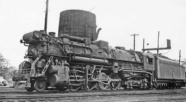
The Tennessee Alabama & Georgia Railway, often simplified as the TAG Route, which also was its reporting mark, was a short line railroad running from Chattanooga, TN southwest to Gadsden, AL for a distance of roughly 90 miles. Tennessee Alabama & Georgia 602 Steam Engine The railroad began operations in 1891 under the name of the Chattanooga Southern Railway, nicknamed the Pigeon Mountain Route, as it followed the area of Pigeon Mountain, which was the basis for its freight haul - namely coal, timber and iron. 1893 Timetable. Image: HawkinsRails An 1892 map shows that the ultimate plan of the road was to extend southwesterly from Gadsden to Birmingham, but this never came to fruition for the company - although the two cities were already connected by rail via Attalla, AL. "Map showing the proposed Tennessee, Alabama, and Georgia Railroad connecting and extending the Chattanooga Southern Railway, Marietta and North Georgia Railway, Knoxville, Cumberland Gap and Louisville

Another LiDAR Find: The Oklahoma & Arkansas Railway

Image
The Oklahoma and Arkansas Railway was a short line railway roughly twenty miles in length, running from Salina, OK eastward to a point referred to as Day, OK. Despite its name, it operated exclusively in the state of Oklahoma in both Mayes and Delaware County.  Construction began in 1921, with the line wholly owned by the  National Hardwood Company  in pursuit of timber interests. Neither Salina Junction (or Kenwood Junction), nor Day, Oklahoma exist on maps anymore, and for us to find the line, it took numerous resources to find the track of the railway. The line is among the more obscure lines, and it only ran between 1921-1926 between the aforementioned points. Having such a short life meant that the remaining track of the line was invisible on satellite imagery, which can also be attributed to the terrain of the area. It also meant that it managed to avoid being on USGS Topo Maps, since it was too late to be included on the 1904 Siloam Springs Quad, and had been long abandoned by t

L’Epiphanie & L’Assomption Railway: A Short Lived Short Railway

Image
Guest blogger Alain Bernier returns to discuss some of Quebec's abandoned railways. If you'd be interested in doing a guest blog yourself, feel free to reach out, we always appreciate those willing to help add relevant content to our site! With that said, here's Bernier's post about the short line L’Epiphanie & L’Assomption Railway. L’Epiphanie & L’Assomption Railway: A short lived short railway 1886-1903 © Alain Bernier, 2021  The L’Epiphanie & L’Assomption Railway (also known as the L’Assomption Railway Company) was a very short 3.33-mile (i) line connecting the villages of L’Assomption and L’Épiphanie, both located  some 30 miles from Montréal in the Lanaudière region of the province of Quebec, Canada. It was as short lived as it was short and its history is closely linked to the Quebec, Montreal, Ottawa and  Occidental Railway (QMO&OR).  Photo 1 : The steam locomotive and the passenger carriage at the terminus in L’Assomption (Source: Fonds de la vi

The Cadiz Railroad

Image
Much like the Union Railroad of Oregon brought rail service to Union, OR; the Cadiz Railroad did the same for the citizens of Cadiz, KY, who were otherwise without rail service, with the Illinois Central Railroad line about eight miles east at Gracey as the closest connection to the network. Cadiz Railroad 100. Image: Trigg County Historical Society The eponymous railroad would give the city rail service, running 10 miles west from Gracey, KY, and a junction with the Illinois Central, to downtown Cadiz.  The original track of Cadiz Railroad in Brown between Gracey (or Cadiz Jct.) and Cadiz as shown on our Abandoned & Out-of-Service Railroad Lines Map . Grading began in 1901, and the route surveyed included unnecessary curves to artificially increase the size of the line from the eight miles from Gracey, to 10 miles. This source  suggests that this was done to make the road an "official" railroad, but I have never heard of ten miles being the cut-off for such a status, if

The Cosmopolitan Railway

Image
In 1893, a footnote to the Book of the [Chicago World's] Fair stated, "The connection of the railroad systems of the world by way of Bering strait is by no means the chimerical project that some would have us believe, nor one that may not ere long be accomplished". 128 years later, such a link still has yet to come to fruition, nor will it in the near future. But that isn't to say that the idea is dead, far from it, and the project is now more technically feasible than ever, even if there would be countless environmental, economic and social issues to hammer out first.  Just five years ago, China began planning for a railway that would connect it to Russia, the United States and Canada via a 200 kilometer tunnel . Artistic rendition of the Bering Strait Railway Tunnel. From Bering Strait Tunnel Back on World Agenda! by Rachel Douglas, 21st Century Science & Technology, Spring/Summer 2007 Since a connection between North America and Asia has been in humanity'

Interstate 97: Why it Exists and How to Remove It

Image
I am not a fan of I-97; the number, not the road itself. The road itself is a short but important connection between Baltimore and Annapolis, MD, but it exists as only a 17 mile freeway, shorter than most three digit interstates. In fact, it is by far the shortest primary interstate highway, that is, one with only two digits in its numbering, and while I-87 in North Carolina (sadly) exists; it is planned to connect to Norfolk, VA, along a corridor longer than 100 miles in length.  That numbering will almost certainly be an entire blog of its own, but today we're going to explore how I-97 came into being as the short connector route that it is today, and how it could be incorporated into a much longer route.  A state-named Northbound I-97 Mile Marker. Famartin, Wikipedia Commons  - 2018. I propose five alternatives in renumbering, although I'm certain none will be acted upon, it's been a fun exercise for road enthusiasts to fix issues with the Interstate Highway System, such

The Telegraph Rd Behind Dire Straits' "Telegraph Road"

Image
"And the dirty ole' track...was the Telegraph Road"...the first time I heard those lyrics, I knew I was listening to one of the most incredible songs I'd ever heard. To find out it was based on an actual  Telegraph Rd was just the icing on the cake. Before the creation of Interstate 75, The major thoroughfare between Toledo and Detroit was Telegraph Road . Currently carrying US Highway 24, Telegraph Road was immortalized as a song by Dire Straits in their 1982 album "Love Over Gold".  Early travel brochure for US-24, showing its importance as a road one could use between Los Angeles and Quebec; although it only ran from Michigan to Colorado. If you have 14 minutes to spare, the song is an awesome bit of 80's progressive rock. Today we're going to do things slightly different, in that I was to discuss the history of both the road and the song, because I think the lyrics do a great job to that end. The modern-day Telegraph Road is one of the major par

A Railroad into the Clouds: The Mount Washington Cog Railway

Image
A New Hampshire state legislator in the 1850's suggested that Sylvester Marsh, who was planning a railroad line from the base to the summit of Mount Washington, New Hampshire, should be granted the charter; not just to the summit, but to the moon as well, for how impossible such a railroad line would be. At over 6,200 feet in height, Mount Washington is the tallest mountain in the Northeastern United States, and its summit is well above the tree line, making the ascent feel similar to the much higher mountain terrains in the Rocky Mountains. Despite the incredible prominence of the mountain, Marsh was undeterred, and even put $5000 of his own money towards the project, which helped secure the charter for the railroad. In 1868, Marsh would prove his detractors wrong when his railroad was completed, one of the first rack and pinion railways in the world, and to this day the second-steepest grade in existence. This line is the Mount Washington Cog Railway , which we visited during La