Why is a short road in Will County named the Chicago-Bloomington Trail?
There's a mystery I've been wanting to solve each time I venture down Cedar Rd in central Will County.
A slightly-over one mile stretch of road extends from Cedar Road to Hadley Road in unincorporated Will County, near the similarly named settlement of the same name. Were it not named the Chicago Bloomington Trail, it wouldn't bear much though, but given how it's quite far from Chicago, and very far from Bloomington, IL, the nearest Bloomington that comes to mind, one has to wonder if it is a surviving relic that was once part of a much longer road/trail?
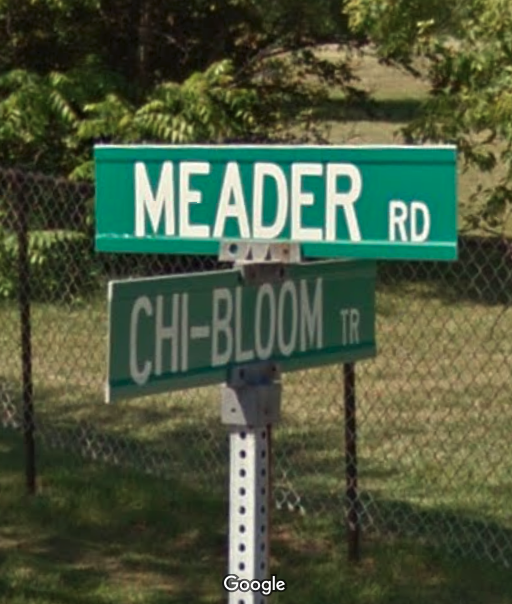 |
| Chicago-Bloomington Rd at Meader Rd. (Google Maps Street View) |
The answer, like with many roads in the US, is yes, or more accurately, perhaps. It has its origins in old Indian trails, but was plowed as a singular route between Chicago and Bloomington in 1831-34 by new settlers looking to connect their claims on bodies of water and provide easy access to trade amongst themselves and within the two cities.
The original alignment(s) of the trail meandered more than you would expect a through road to, but one must understand that the trail was built to serve traders and farmers of the area, and thus wasn't a straight shot between Chicago and Bloomington. In fact, the original trail didn't even have bridges over the rivers and streams, requiring ferries to transport travelers and goods across.
While we think of roads today through the lens of the automobile, for most of history, roads have been used by travelers on foot, or wagon trail, or horseback, and were obviously not paved. This Trail predated even the Auto Trails. While the important roads of the early days by and large were incorporated into the road network of today, more often than not, they have been realigned over time to better match modern traffic patterns. Thus, the present-day Chicago Bloomington trail road is one of these earlier alignments that managed to keep its name, and one of the few that remain a public road.
Archer Avenue would be built along the I&M canal and straighten the trail out in the Chicago area, leaving this stretch to serve a development along the older section, Hadley.
Hadley, which is where the aforementioned road along the trail takes its name from, was a small but prosperous settlement along the road, but is a ghost town today. The area had a church, Hadley Baptist Church, first started in 1833 and is still active, although renamed and relocated as the Marley Community Church.
 |
| Chicago-Bloomington Trail from Cedar to its continuation as Hadley Rd. The eastern two-thirds are the road are in present-day Homer Glen, which annexed the Hadley area. |
Named for Hadley, MA, Hadley, IL's fortunes came and went with the canal and railroad, as the Chicago Bloomington Trail was no longer a through route, it never expanded beyond the church, post office, and a couple stores.
 |
"The Stone House, also known as the Gorham-Frazer farmhouse in Homer Glen, was part of a working farm, rendered here in the Combination Atlas Map of Will County of 1873. " (Will County Land Use/Will County / Handout) via the Chicago Tribune. |
Another settlement on the trail was Mazon. The Village of Mazon website has some more history on this trail in their town, Mazon. "Mazon's early history was very important for the area's growth with the Chicago-Bloomington Trail. Travelers would stay at the Halfway House prior to the development of the Illinois Michigan Canal." Mazon was located about halfway between Chicago and Bloomington, hence the name of the house. But interestingly, present-day Mazon is located a few miles northwest of the original settlement, this was done to link up with the railroad when it was completed.
This being Illinois, I must shoehorn Abraham Lincoln somewhere in here as well, and say that it's almost certain Lincoln used the trail commuting between Bloomington and Chicago.
And this also wouldn't be Forgotten Railways Roads & Places if I did not shoehorn an abandoned, or in this case, unbuilt, railroad in here somewhere. The Chicago Joliet & Peoria Railroad, an ancestor to the Chicago Rock Island & Pacific, was planning to built east from Joliet, and while they eventually did, using the still existent Rock Island Line (now owned by Metra and used by Iowa Interstate), another grade was proposed to run north of Hadley.
 |
| Homer Township Plat Map, 1873, showing the proposed Chicago Joliet & Peoria Railroad line north of Hadley. It's possible small amounts of grading took place, but this alignment was never built. |
The Chicago-Bloomington Trail was known more popularly as the "Chicago" Trail, and would be supplanted in large part by both the canal industry and the railroad industry, meaning that much of the original Chicago Bloomington Trail no longer exists as a public road. In fact, it's likely that the trail re-aligned itself multiple times in its early years, if not several times a year depending on the conditions on the ground.
I find it fascinating that this is one of the very few remnants that weren't conquered by private property, the canal, and later the Chicago & Alton Railroad, Archer Avenue, Route 66, and Interstate 55, and even more fascinating that the name remains on the road to this day, in spite of infrastructure and technological advances that made it redundant.
Thanks as always for reading!


hello - do you study this particular area's history? Or do you study a wide range of historical cities?
ReplyDelete