Mapping the Forgotten CTA "L" Stations
I haven't really discussed much about the CTA's rail lines, short for the Chicago Transit Authority, and its history on this blog for two reasons. One is that many historians and the Illinois Railway Museum have done a tremendous job of preserving its history, as well as discussing it and the other interurban lines around Chicago in various blogs, most notably The Trolley Dodger and the Chicago-L, among others.
 |
| Isabella Station, now closed, once on the present-day CTA Purple Line. Tim Collins photo collection, and CTA Archives. |
The second, and probably larger reason, is that the entire system's history is actually quite complex; what is now composed of a system of color-coded lines comes from several different systems and branches that have merged into the current Chicago Transit Authority over time. I do my best not to discuss things I'm not certain about, and of course if I'm wrong about the slightest fact, an army of railroad historians will be rushed to my location to correct me as soon as humanly possible.
 |
| Image: Kostner Station from the Eisenhower Expy. Google Street View Image |
But after driving into the city for the better part of the last two years and observing the above station on my drive in, I was left with a thought in my head I could no longer ignore...namely, how long has that station been closed? (1973). Why did it close? How many more abandoned train stations exist along the CTA?
The above blogs and the railway museum are excellent spots for information, and without them I would not have been able to complete this map, but they are hard to analyze if you're thinking in terms of place of these stations. Thus, I decided to create my own map of Abandoned or Closed CTA Stations, embedded below.
As our abandoned railroad lines map focuses on just that, abandoned lines, I wouldn't be able to add the Kostner Station, as the Blue Line is still running 24/7/365.
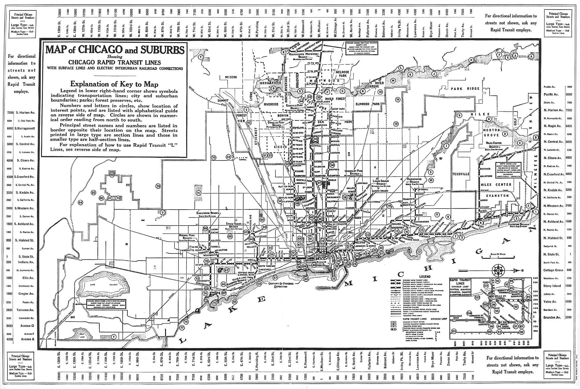
 |
| A 1933 Map of Chicago and Suburban Rapid Transit via Chicago-L.org |
So the following map includes all current CTA trackage, as well as the stations along the abandoned branches of the system, and when these stations were closed. My hope is that this map will help tell the story of the CTA as I best know how, by plotting points!


Comments
Post a Comment